|
West Texas A&M University, Canyon, TX Current Weather Conditions
[Select Refresh to Update]
Updated Automatically by Ambient Weather's Virtual Weather Station
V14.00
|
Conditions
at 10:57pm on 3/6/15 Temperature |
3.3°C |
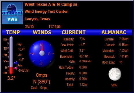          
|
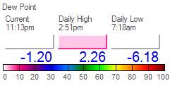
| Dew Point | -0.9°C | ||
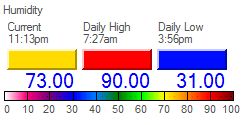
| Humidity | 74% | ||
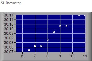
| Barometer | 30.11in Rate 0.008in/hr |
||
| Wind Direction | N | ||
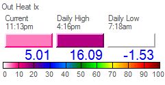
| Heat Index | 5.2°C | ||
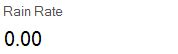
| Rainfall for Today | 0.00in | ||
| Total Rainfall | 1.12in | ||
| Today's Extremes | |||
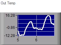
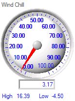
| High Temperature | 16.4°C at 4:16pm | ||
| Low Temperature | -4.5°C at 7:18am | ||
| High Heat Index | 16.1°C at 4:16pm | ||
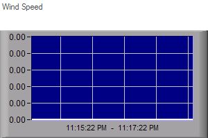
| Peak Wind Gust | 0mps at 12:00am | ||
| Astronomical Data | |||
| Sunrise | 7:08am | ||
| Sunset | 6:45pm | ||
| Moonrise | 7:53pm | ||
| Moonset | 7:31am | ||
|
|
|||
Updated Automatically by Ambient
Weather's
Virtual Weather Station V14.00
©All rights reserved.
Unauthorized duplication or distribution is prohibited
Never base important decisions on this or any
weather information obtained from the Internet